
2008, ISBN: 9783860386156
Letzte Aktualisierung am: 17.12.18 08:40:17 Binding: Landkarte, Label: Landesamt für Digitalisierung, Breitband und Vermessung, Bayern, Publisher: Landesamt für Digitalisierung, Breitband… More...
| medimops.de Nr. M03860386158LibriNew. Shipping costs:Versandkostenfrei ab einem Warenkorbwert von 10€, 1-3 Tage, zzgl. Versandkosten., plus shipping costs Details... |

2008, ISBN: 9783860386156
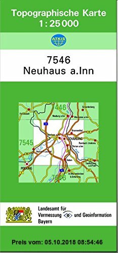
Letzte Aktualisierung am: 05.10.18 08:54:46 Binding: Landkarte, Label: Landesamt für Digitalisierung, Breitband und Vermessung, Bayern, Publisher: Landesamt für Digitalisierung, Breitband… More...
| medimops.de Nr. M03860386158LibriNew. Shipping costs:Versandkostenfrei ab einem Warenkorbwert von 10€, 1-3 Tage, zzgl. Versandkosten., plus shipping costs Details... |

2008, ISBN: 9783860386156
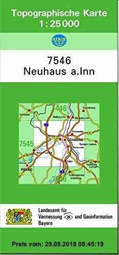
Letzte Aktualisierung am: 29.09.18 08:45:19 Binding: Landkarte, Label: Landesamt für Digitalisierung, Breitband und Vermessung, Bayern, Publisher: Landesamt für Digitalisierung, Breitband… More...
| medimops.de Nr. M03860386158LibriNew. Shipping costs:Versandkostenfrei ab einem Warenkorbwert von 10€, 1-3 Tage, zzgl. Versandkosten., plus shipping costs Details... |

2008, ISBN: 9783860386156
[ED: Karte], [PU: Landesamt für Digitalisierung, Breitband und Vermessung, Bayern], DE, [SC: 0.00], Neuware, gewerbliches Angebot, [GW: 40g]
| booklooker.de verschiedene Anbieter Shipping costs:Versandkostenfrei, Versand nach Deutschland. (EUR 0.00) Details... |

| BookDepository.com Shipping costs:Versandkostenfrei. (EUR 0.00) Details... |


Gebr. - TK25 7546 Neuhaus a.Inn: Topographische Karte 1:25000 (TK25 Topographische Karte 1:25000 Bayern) - new book
2008, ISBN: 9783860386156
Letzte Aktualisierung am: 17.12.18 08:40:17 Binding: Landkarte, Label: Landesamt für Digitalisierung, Breitband und Vermessung, Bayern, Publisher: Landesamt für Digitalisierung, Breitband… More...

2008, ISBN: 9783860386156
Letzte Aktualisierung am: 05.10.18 08:54:46 Binding: Landkarte, Label: Landesamt für Digitalisierung, Breitband und Vermessung, Bayern, Publisher: Landesamt für Digitalisierung, Breitband… More...
2008
ISBN: 9783860386156
Letzte Aktualisierung am: 29.09.18 08:45:19 Binding: Landkarte, Label: Landesamt für Digitalisierung, Breitband und Vermessung, Bayern, Publisher: Landesamt für Digitalisierung, Breitband… More...
2008, ISBN: 9783860386156
[ED: Karte], [PU: Landesamt für Digitalisierung, Breitband und Vermessung, Bayern], DE, [SC: 0.00], Neuware, gewerbliches Angebot, [GW: 40g]

ISBN: 9783860386156
Sheet map, [PU: LDBV Bayern]
Bibliographic data of the best matching book

| Author: | |
| Title: | |
| ISBN: |
Details of the book - Topographische Karten Bayern, Bl.7546 : Neuhaus a. Inn
EAN (ISBN-13): 9783860386156
ISBN (ISBN-10): 3860386158
Hardcover
Publishing year: 2002
Publisher: Landesamt für Digitalisierung, Breitband und Vermessung, Bayern
Book in our database since 2008-10-20T14:43:32+01:00 (London)
Detail page last modified on 2018-12-19T22:02:56+00:00 (London)
ISBN/EAN: 3860386158
ISBN - alternate spelling:
3-86038-615-8, 978-3-86038-615-6
Alternate spelling and related search-keywords:
Book author: bay landesamt für, bayern
Book title: topographische karten bayern, neuhaus inn, topographische karte, tk25, hefte 754
Information from Publisher
Author: Landesamt für Digitalisierung, Breitband und Vermessung, Bayern
Title: TK25 Topographische Karte 1:25000 Bayern; TK25 7546 Neuhaus a.Inn - Topographische Karte 1:25000
Publisher: Landesamt für Digitalisierung, Breitband und Vermessung, Bayern
Publishing year: 2008-01-04
DE
Printed / Made in
Weight: 0,040 kg
Language: German
6,20 € (DE)
6,40 € (AT)
Withdrawn from sale
CB; Karten, Globen / Reisen/Karten, Stadtpläne, Atlanten/Deutschland; Landkarten und Atlanten; Wandern, Radwandern; Tourismus, Planung; Bayern; Schule, Unterricht; Topographische Karte; Deutschland; Touristen,
Autofahrer,
Schulen,
Lehrer,
Unterrichtende,
Planungsbehörden,
Verwaltung,
Rettungsdienste
< to archive...